Subject: Bermuda
Period: 1630 (circa)
Publication: Atlas Minor
Color: Hand Color
Size:
10.1 x 7.5 inches
25.7 x 19.1 cm
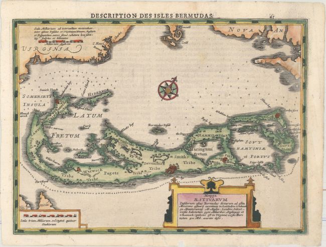
Lovely small map of Bermuda from this slightly larger format of Mercator’s Atlas Minor. The map is derived from the famous Norwood/Speed map of 1622. The various "tribes" are noted along with numerous settlements. Virginia appears to the northwest, Cape Cod is due north. Bermuda is shown twice on the map - once as the central feature, and a second time showing the island in relation to the coasts of North America and Hispaniola. A strapwork title cartouche and compass rose adorns the map. French text on verso, published in 1630 and 1636. Title above upper neatline reads Description des Isles Bermudas.
References: Van der Krogt (Vol. III) #9660:353.
Condition: B+
Crisp and clean on a sheet of watermarked paper. There is an unobtrusive tear at top right that has been repaired on recto with light Japanese tissue, an edge tear confined to the bottom blank margin that has been closed on verso with archival tape, and a couple of small chips in the bottom blank margin.