Subject: St. Helena
Period: 1743 (published)
Publication: The English Pilot, The Third Book
Color: Hand Color
Size:
20.6 x 16.9 inches
52.3 x 42.9 cm
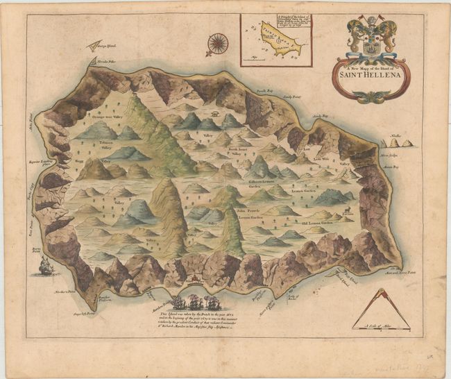
This map of St. Helena depicts the coastline completely surrounded in rocky terrain, with numerous additional mountains inland. The only settlement is James Fort, beside which are three ships engaged in battle and the notation that the island had been taken by the Dutch in 1672 and then retaken by the British the following year. Several lemon gardens and an orange tree valley are noted inland, and two mountain goats and a wild boar are depicted. At top is a small inset of the island of Trinidad. The map is adorned with a compass rose orienting north to the bottom left, a distance scale topped by calipers, and a decorative title cartouche.
References: Shirley (BL Atlases) M.M&P-4b.
Condition: B+
A crisp impression on a sturdy sheet with light soiling, toning and foxing.