Subject: Atlantic Ocean
Period: 1746 (dated)
Publication: Histoire Generale des Voyages
Color: Hand Color
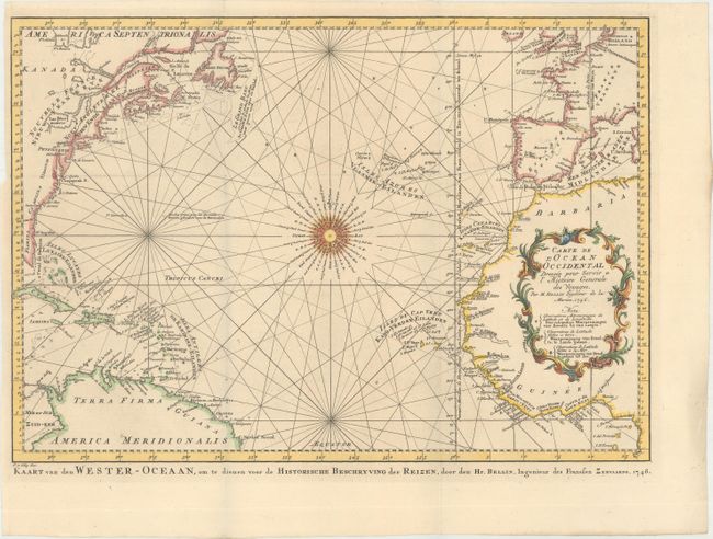
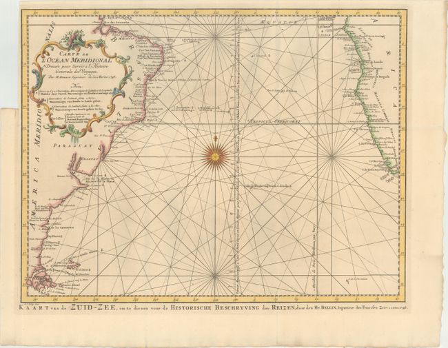
This Dutch edition of Bellin's pair of maps depicts the entire Atlantic Ocean. Each chart is centered on a stunning 32-point compass rose and delineated with rhumb lines. A good portion of the Americas, Europe, and Africa are shown with major port cities named. The coast of North America is labeled with the colonies Florida, Carolina, Virginie, Pensilvanie and Nouve. Angleterre, Ne. Ecosse, and Acadia. The important fishing banks of North America are prominently depicted. The Prime Meridian is shown through I. Ferro with an alternate Prime Meridian shown through Paris. Dutch text appears below the bottom border.
A. Carte de l'Ocean Occidental Dressee pour Servir a l'Histoire Generale des Voyages (17.6 x 12.4").
B. Carte de l'Ocean Meridional Dressee pour Servir a l'Histoire Generale des Voyages (17.6 x 13.4").
References:
Condition: A+
Crisp, dark impressions on watermarked paper. Issued folding with binding trims at at upper left.