Subject: Venezuela
Period: 1633 (published)
Publication: Gerardi Mercatoris et I. Hondii Atlas...
Color: Hand Color
Size:
19.3 x 14.8 inches
49 x 37.6 cm
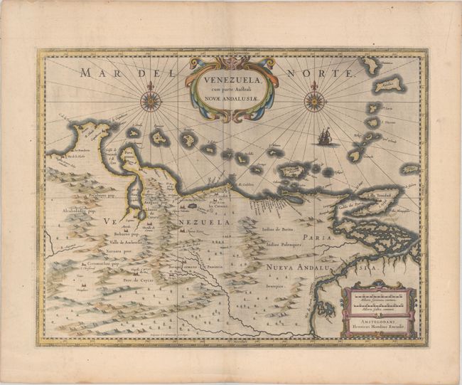
This beautifully engraved map is based on the cartography of Hessel Gerritsz. It covers the northern coast of South America, Venezuela, east to the mouth of the Orinoco, and includes the offshore islands from Aruba through Dominica and Tobago. The fine engraving illustrates the mountains, forests, rivers and missions in the interior, but shows place names primarily along the coastlines owing to the relatively few explorations made into the interior. The map is richly embellished with title and distance scale cartouches, compass roses and a galleon. Engraved by E.S. Hamers-veldt and S. Rogeri. French text on verso
References: Van der Krogt (Vol. I) #9830:1.1.
Condition: B+
A nice impression that is slightly weak in the border at left, with some printer's ink residue, a small rust stain south of Caracas, and extraneous creasing along the centerfold.