Subject: Gulf of Mexico & Caribbean
Period: 1780-94 (circa)
Publication:
Color:
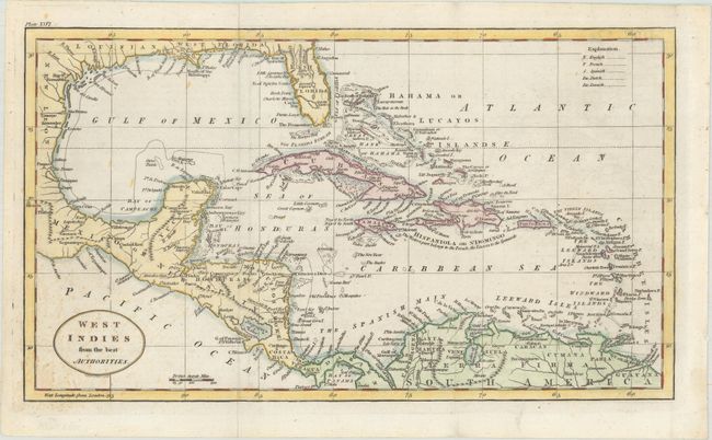
A. West Indies from the Best Authorities, by William Guthrie, from A New Geographical, Historical, and Commercial Grammar..., circa 1794, hand color (12.9 x 7.4"). This map of the West Indies was engraved by John C. Russell. At this time Florida was divided into East and West Florida. East Florida is shown having two mountain ranges. The map also shows part of Mexico plus the Central American countries and parts of South America. There is a table at the upper right showing the codes used to demonstrate the European possessions in the islands. Ref: McCorkle (18th C. Geography) #171-22. Condition: Issued folding with some small light stains at bottom left.
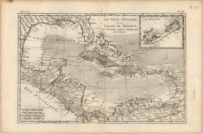
B. Les Isles Antilles, et le Golfe du Mexique, by Rigobert Bonne, from Raynal's Histoire Philosophique et Politique, circa 1780, black & white (12.7 x 8.3"). This beautiful and strongly engraved chart of the Caribbean also features good detail of Central America. Along the Gulf Coast and Florida, New Orleans, Pensacola, and St. Augustine are named. Navigation routes, trade winds, rocks, and shoals are identified. An inset of Bermuda is located at upper right. Ref: Sellers & Van Ee #1705. Condition: A dark impression on watermarked paper with light offsetting.
References:
Condition: B+
See description above.