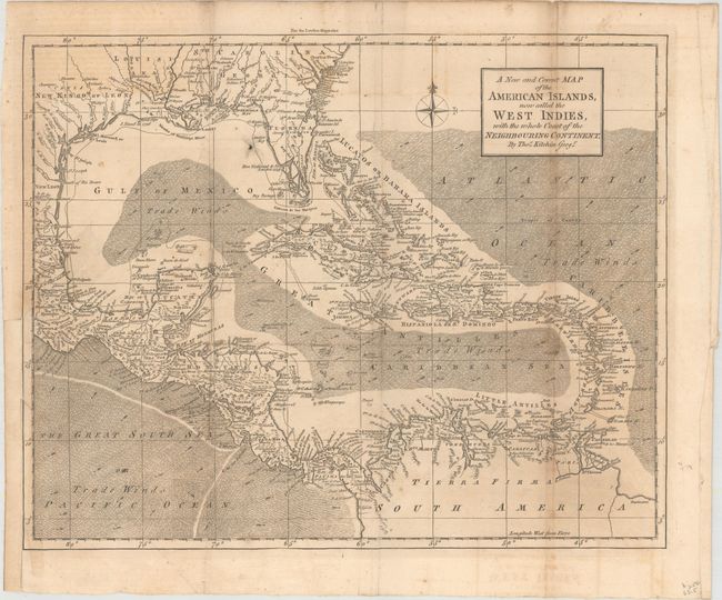
Subject: Gulf of Mexico & Caribbean
Period: 1762 (published)
Publication: London Magazine
Color: Black & White
Size:
13.9 x 11.2 inches
35.3 x 28.4 cm
A finely engraved map of the Caribbean extending to include the southern United States and the northern coast of South America. It shows the sailing routes, and the directions of the trade winds are noted by hachure and arrows. Southern Florida is depicted as an archipelago of islands with interconnected waterways. Place names fill the map, particularly along the coast and in the islands. The Florida peninsula is truncated with the southern tip a mass of irregularly shaped islands.
References: Jolly #LOND-216; Sellers & Van Ee #1692.
Condition: B
Issued folding with occasional light toning and offsetting. A 2" binding tear at left has been repaired with archival tape and several tiny splits at fold intersections have been repaired on verso with old paper. The binding trim at lower left has been replaced with old paper.