Subject: Virginia
Period: 1843 (circa)
Publication:
Color: Hand Color
Size:
13.5 x 10.9 inches
34.3 x 27.7 cm
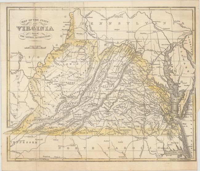
A scarce map of Virginia that details the cities, villages and counties with topography shown by hachure. This is an uncommon map for which we find but a few university references, and was apparently issued in Henry Howe's Historical Collections of Virginia.... We've dated it 1843 because the counties of Marion and Ritchie were formed in that year and are clearly shown on the map while Taylor County that was formed in 1844 is not on the map.
References:
Condition: B+
Issued folding and now flattened and backed with linen to reinforce and repair several separations along the left fold. Minor soiling and offsetting.