Subject: Texas
Period: 1873 (dated)
Publication:
Color: Hand Color
Size:
27.5 x 17 inches
69.9 x 43.2 cm
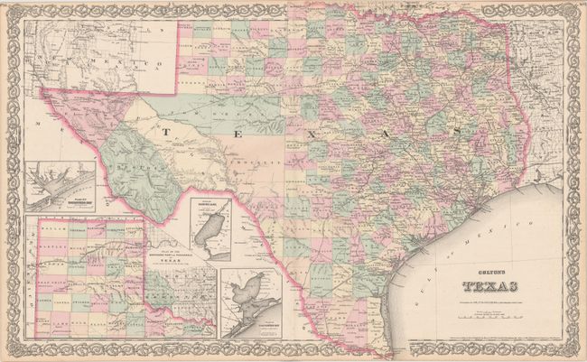
This later edition Colton is an interesting double page map that uses the title of the earlier (1855-59) single-sheet map but presents the same information as the double page "New Map of the State of Texas Compiled from J. de Cordova's large Map," also published in the 1850's. The map presents extensive detail throughout the settled part of the state. The western corner is still comprised of the large unsettled areas of Presidio, El Paso, and Pecos, but Bexar and Young territories have been entirely replaced with new counties, suggesting a circa date of 1876. Includes excellent detail of railroads, forts, post offices, roads, springs, watershed and topography. Features the large inset "Plan of the Northern Part or Panhandle of Texas" plus three smaller insets: "Plan of Galveston Bay from the U.S. Coast Survey"; "Plan of Matagorday Bay"; and "Plan of Sabine Lake". This handsome sheet has fancy titling and a decorative scroll border.
References:
Condition: A
A clean and bright example with just a hint of toning along the sheet edges.