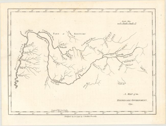
Subject: Tennessee
Period: 1794 (dated)
Publication: The American Geography
Color: Black & White
Size:
9.2 x 6.6 inches
23.4 x 16.8 cm
This map was published in 1794 in the London (Stockdale) edition of Jedidiah Morse's The American Geography, which was the first compendium of descriptions and maps of the fledgling United States, preceding Scott, Carey, Reid and others. Although Mathew Carey has been given credit for publication of the first map of the state, Carey's map is undated and first appeared in his atlas in 1795, a year after this map, which is dated September 20, 1794. Both maps are based upon the surveys of General Daniel Smith, however Carey's map is updated with more detail. Morse's map identifies only three cities - Nashville, Knoxville and Clarksville - and does not include state boundaries, which were likely still uncertain at time of publication. Carey includes boundary information, topographical details, as well as additional place names. This is a rare, early map with only a few copies of sales noted.
References: Howes #M840; McCorkle (18th C. Geography Books) #302 [20]; Sabin #50924.
Condition: A+
A clean and bright example on paper watermarked "RD 94" with one faint crease.