Catalog Archive
Auction 161, Lot 348

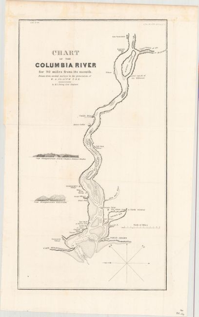
"Chart of the Columbia River for 90 Miles from Its Mouth. Drawn from Several Surveys in the Possession of W.A. Slacum U.S.N.", U.S. Government

Subject: Oregon & Washington

Period: 1838 (circa)

Publication: Sen. Doc. #470, 25th Congress, 2nd Session

Color: Black & White

Size:
9 x 16.3 inches
22.9 x 41.4 cm
Download High Resolution Image
(or just click on image to launch the Zoom viewer)

Detailed map of the river from Point Adams/Cape Disappointment east to Ft. Vancouver, showing villages along the way. The map shows the navigability of the river with soundings, sand bars and islands. It was drawn from several surveys in the possession of W. A. Slacum, USN. This is a companion map to Hood's map of the United States Territory of Oregon West of the Rocky Mountains.

References: Claussen & Friis #222.

Condition: B+

Issued folding on a bright sheet with minor offsetting of the border and very faint scattered foxing mostly in the blank margins.

Estimate: $140 - $170

Unsold

Closed on 2/8/2017

Archived