Subject: Atlantic City, New Jersey
Period: 1864 (dated)
Publication:
Color: Black & White
Size:
17.3 x 14.5 inches
43.9 x 36.8 cm
The Office of Coast Survey is the oldest U.S. scientific organization, dating from 1807 when Congress directed that a "survey of the coast" be carried out. By 1836, it was called the U.S. Coast Survey and in 1878, the name was changed to the U.S. Coast and Geodetic Survey. Today the Office of Coast Survey is a division of the National Oceanic and Atmospheric Administration NOAA.
The survey teams, composed of civilians as well as Army and Naval officers, charted the nation's waterways and produced a wide array of reports, survey charts, hydrographic studies of tides and currents, astronomical studies and observations, and coastal pilots. These charts are an important record of the changing nature of the nation's coastlines. In additional to coastal charts, the U.S. Coast and Geodetic Survey produced land sketches, Civil War battle maps, and the early aeronautical charts.
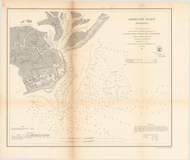
This chart depicts the region around Absecon Inlet, including Atlantic City. Individual buildings and the street-grid pattern of the city are shown. The water features include numerous soundings, buoys, bottom types, and notes on tides, soundings, and the Absecon Lighthouse. The lighthouse is the third largest in the United States, and the tallest in New Jersey. All references to Absecon are spelled Absecom in the chart, including the title.
References:
Condition: B
Issued folding with light toning along one fold, two separations that have been closed on verso with archival tape, and a few spots of foxing.