Catalog Archive
Auction 161, Lot 324

"Wright's Map of Kansas City", Page, H. R.

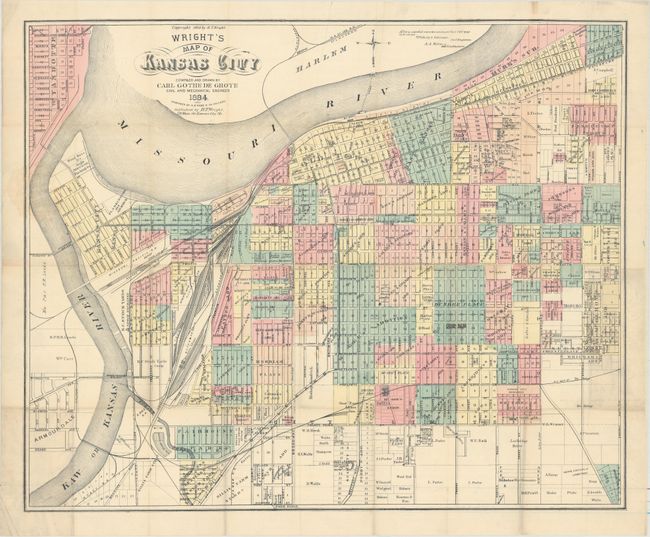
Subject: Kansas City, Missouri

Period: 1884 (dated)

Publication:

Color: Hand Color

Size:
24.3 x 19.8 inches
61.7 x 50.3 cm
Download High Resolution Image
(or just click on image to launch the Zoom viewer)

This detailed map of Kansas City is delineated by neighborhood/addition and shows individual lots, businesses, railroads, streetcars and more. The map was drawn by Carl Gothe de Grote, a local civil engineer, and engraved by the H.R. Page firm in Chicago. The map was originally issued by H.T. Wright and was accompanied by a small guide book that is not present.

References: Phillips (Maps) p. 348.

Condition: B+

Issued folding and now flattened and backed with tissue. There are a few tiny repaired fold separations and one minor ink notation in the image.

Estimate: $250 - $325

Unsold

Closed on 2/8/2017

Archived