Subject: Mississippi
Period: 1857 (dated)
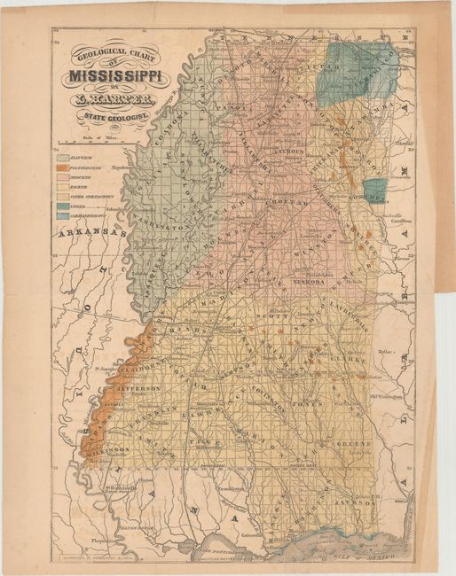
Publication: Preliminary Report on the Geology and Agriculture of the State of Mississippi
Color: Hand Color
Size:
9.6 x 14.1 inches
24.4 x 35.8 cm
This is the earliest comprehensive geological map of Mississippi, and was issued in Lewis Harper's Preliminary Report on the Geology and Agriculture of the State of Mississippi. The map is preceded only by an uncolored sketch map by Lieber in 1857 (Marcou #551) and identifies seven different geological types via hand coloring. In addition to the geology, the map is delineated by county and depicts the major railroads, roads and rivers in the state.
References: Marcou & Marcou #559.
Condition: B+
Issued folding with light toning and offsetting. There is an archivally repaired short binding tear that is confined to the right blank margin, and a few minor repaired fold separations with all but one confined to the blank margins.