Subject: Maryland
Period: 1893 (dated)
Publication: Bulletin of the United States Fish Commission
Color: Printed Color
Size:
22 x 35 inches
55.9 x 88.9 cm
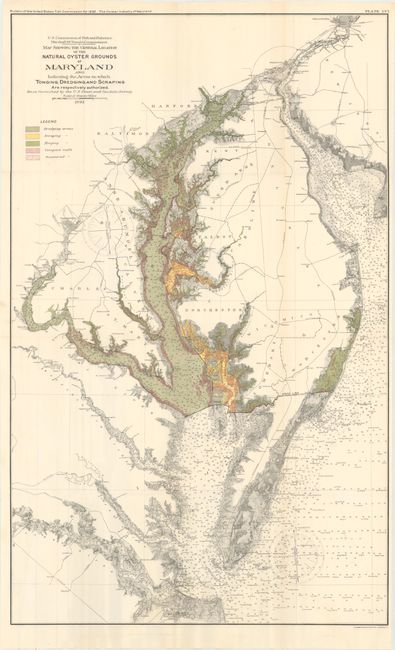
This colorful chart details oyster fishing beds throughout Chesapeake Bay and part of Chincoteague Bay in remarkably fine detail. The map locates Washington, D.C., Annapolis, Baltimore and Philadelphia in street grid pattern. It locates areas where oyster gathering is authorized, and by which method, as shown by the color coded key at upper left. By the 1870's, Maryland's oyster fields were becoming severely depleted, which led to oyster management efforts in the form of laws and regulations. This informative map is from one of the reports of that effort.
References:
Condition: A
Issued folding with vivid color. There are two nearly invisible, short edge tears along the left and top border that have been closed on verso with archival tape.