Catalog Archive
Auction 161, Lot 314

"Map of the Coast of Maine [Western Part]", Walker, George H. & Co.
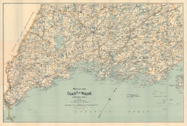
Subject: Maine

Period: 1893 (dated)

Publication:

Color: Printed Color

Size:
30.5 x 20.5 inches
77.5 x 52.1 cm
Download High Resolution Image
(or just click on image to launch the Zoom viewer)

This map depicts cycling routes in red overprinting, and covers the region from Kittery north to above Rockport. Includes excellent detail along the coastline and surrounding islands. Folds into pictorial paper covers featuring images of the region. Walker also produced a 1905 version of this map and replaced cycling routes with automobile routes.

References:

Condition: B+

A clean and colorful example with a few short splits at fold intersections. Minor foxing to paper wrappers.

Estimate: $80 - $100

Sold for: $60

Closed on 2/8/2017

Archived