Subject: New Orleans, Louisiana
Period: 1761 (published)
Publication: London Magazine
Color: Hand Color
Size:
9.1 x 6.6 inches
23.1 x 16.8 cm
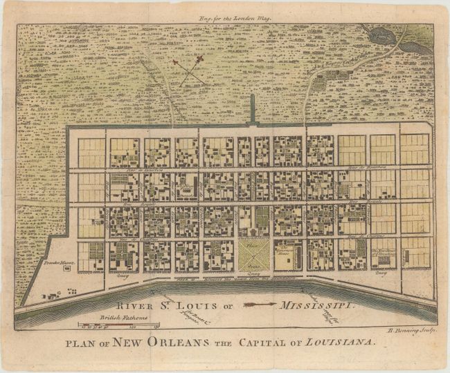
Great little plan detailing the city center, including Bourbon Street, with the roads leading into the city. It shows houses, streets, the Parish Church, municipal buildings, barracks, a powder magazine, a brick kiln, and the New House of ye Ursalines (Ursuline Academy), among its many details. Based on a manuscript map by Le Blond de la Tour that formed the basis of most plans of New Orleans throughout the 18th century. This is one of the earliest available plans printed in English; the first being Thomas Jefferys' plan of 1759.
References: Jolly #LOND-199; Sellers and Van Ee #1679.
Condition: A
Issued folding and now flattened with minor toning and one tiny hole that has been professionally repaired.