Subject: Hawaii
Period: 1903-20 (circa)
Publication:
Color:
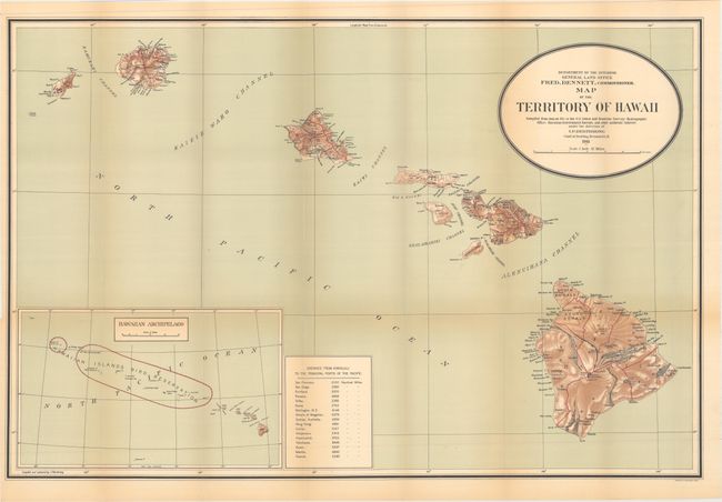
A. Map of the Territory of Hawaii Compiled from Data on File in the U.S. Coast and Geodetic Survey; Hydrographic Office; Hawaiian Government Surveys, and Other Authentic Sources..., by General Land Office, dated 1911, printed color (33.0 x 21.9"). This large and colorful map was "compiled from data on file in the U.S. Coast and Geodetic Survey: Hydrographic Office: Hawaiian Government Surveys, and other authentic sources under the direction of I. P. Berthrong chief of drafting division." Beautifully colored including lithographic shading to suggest terrain. Published under the direction of the commissioner Fred Dennett. Large inset (12.5 x 7.5") at lower left gives a wider view of the entire archipelago and notes in red the Hawaiian Islands Bird Reservation. In 1904 Theodore Roosevelt established this huge reservation, which stretches between Nihoa to Kure Atoll with the exception of Midway. Table at bottom center lists the distances to the principle ports in the Pacific Ocean from Honolulu. Good detail on a scale of 1 inch = 12 miles. Condition: Light toning primarily along the folds and one tiny fold separation. (B+)
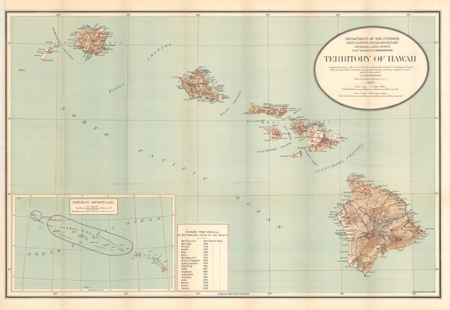
B. Territory of Hawaii Compiled from Data on File in the U.S. Coast and Geodetic Survey; U.S. Geological Survey; Hydrographic Office; Hawaiian Government Surveys, and Other Authentic Sources..., by General Land Office, dated 1920, printed color (32.9 x 21.8"). This is an updated version of the map above, published 9 years later. The table of distances now includes Panama, where the canal opened in 1914. Condition: Light offsetting of title and map border. (B+)
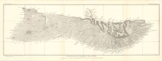
C. Molokai, Hawaiian Islands, by U.S. Geological Survey, circa 1903, black & white (23.0 x 7.6"). Depicts the topography and drainage of the island of Molokai. Based on triangulations by W.D. Alexander and M.D. Monsarrat. Condition: Clean and bright. (A)
References:
Condition:
Issued folding. See description above for details.