Subject: Pensacola, Florida
Period: 1744 (dated)
Publication: Histoire et Description Generale de la Nouvelle France
Color: Hand Color
Size:
11.1 x 7.7 inches
28.2 x 19.6 cm
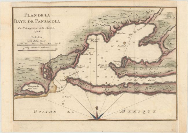
An early chart of Pensacola Harbor, showing the locations of forts St. Charles and St. Rose, as well as soundings and anchorages. This example was engraved from maps and charts brought back to Paris by Pierre Francois Xavier de Charlevoix (1682-1761), a Jesuit historian who explored the Great Lakes, and the Mississippi River Basin from 1721-22. He was shipwrecked near Pensacola on his way to New Orleans. His detailed notes and scientific observations enlivened the memoir on the explorations, Histoire et Description Generale de la Nouvelle France. The map was engraved by Dheulland in Paris under the direction of Jacques Nicolas Bellin.
References: Tooley (MCC-96) #720.
Condition: B+
Issued folding, now flattened, on paper with a bunch of grapes watermark, faint offsetting, and light soiling. Professionally remargined on three sides with old paper.