Subject: World
Period: 1807 (dated)
Publication:
Color: Hand Color
Size:
25.2 x 13.3 inches
64 x 33.8 cm
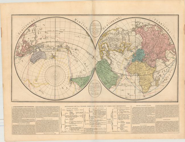
This rare double-hemispheric world map is displayed on an unusual projection, with the North Pole and South Pole falling about a third of the way down or up on the Paris Meridian Line. The seas are filled with the tracks of various explorers including the Polo family, Pigafetta/Magellan, Cook, and Vancouver. Cartographically, the Sea of the West makes a very late appearance on a map allowing for a clear Northwest Passage, and Tasmania is still connected to Australia. Includes a panel of French text at bottom.
References:
Condition: B+
There is light offsetting and light toning, which is slightly more prominent along the centerfold. A short centerfold separation at bottom is confined to the blank margin.