Subject: Arizona
Period: 1911 (dated)
Publication:
Color: Printed Color
Size:
16.6 x 20.3 inches
42.2 x 51.6 cm
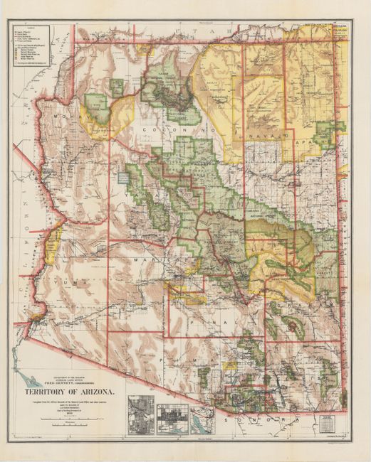
A very colorful map that provides a detailed look at the territory less than one year before statehood. The plate for this map has been completely re-engraved from earlier maps. It now features city plans in insets for Phoenix and Tucson, and an inset showing the roads and railroads connecting Arizona with the Mexican port of Guaymas. The map details the extent of the National Forests (not Forest Reserves as on previous maps) and the Grand Canyon National Game Preserve is delineated. There is good detail of a large number of railroads serving the mining communities. Private land claims are now shown, without mention of confirmed and unconfirmed, and are outlined in red. Details include watershed, mountains, railroads, wagon roads, private claims, unsurveyed townships, and much more. A great territorial period map that was produced under the direction of I.P. Berthrong, Chief of Drafting Division.
References:
Condition: A+
A fine example, issued folding.