Subject: Wisconsin, Iowa, Illinois
Period: 1840 (published)
Publication: HR Doc. 239, 26th Congress, 1st Session
Color: Hand Color
Size:
5.8 x 8.9 inches
14.7 x 22.6 cm
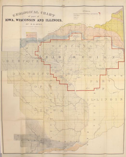
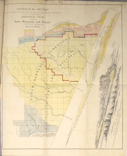
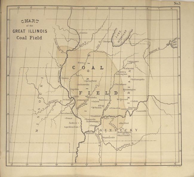
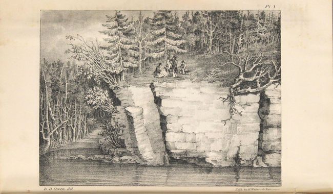
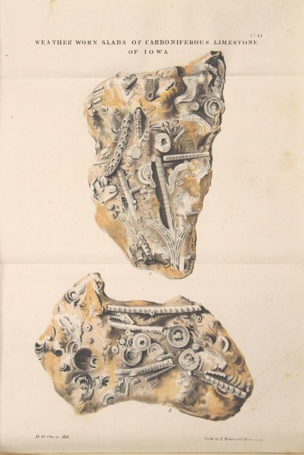
This is David Dale Owen's important report on the first geological reconnaissance of approximately 11,000 square miles of mostly Wisconsin and Iowa territories, along with the northern portion of the state of Illinois. Owen was hired by the U.S. government to survey this large region for valuable minerals before they began opening lands for public sale. He was the first to identify the vast resources of the region, and his surveys were the basis for James Hall's 1843 Geological Map of the Middle and Western States. The report contains a total of 4 folding maps and 21 other illustrations (many folding) including several geological sections, views, and fossil plates. Of particular importance is the large Geological Chart of Part of Iowa, Wisconsin and Illinois (21.8 x 26.5"), which highlights the lead region in red and identifies numerous lead mines, copper ore and iron ore. Other folding maps of interest are Geological Section from the Mouth of Rock River through the Blue Mounds to the Wisconsin River... (10.6 x 12.8") and Chart of the Great Illinois Coal Field (8.4 x 7.7"). First edition (a subsequent Senate edition was published in 1844), disbound, 161 pages with 25 total plates. Very scarce issue with no auction records in the last 30 years.
References: Marcou & Marcou #448-450.
Condition: B+
Maps and plates are very good with occasional scattered foxing and/or light toning. The large map has light toning, faint color offsetting, and a small stain at center. Disbound text has light scattered foxing.