Subject: Central United States
Period: 1884 (circa)
Publication:
Color: Printed Color
Size:
34.7 x 23.8 inches
88.1 x 60.5 cm
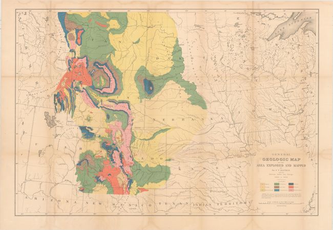
This is the very elusive map #11 that accompanied Hayden's twelfth annual report. According to Marcou & Marcou, the map was published in 1884, a year following the publication of the portfolio and report. Given its later issuance, very few portfolios contain this extra map and are usually seen with either 7 or 10 maps.
The map itself summarizes all of Hayden’s geological mapping activities associated with his U. S. Geological and Geographical Survey of the Territories. Geologic coverage spans an immense region including all of Colorado and Wyoming, most of Montana and Nebraska, the western half of North and South Dakota, and portions of Kansas, New Mexico, Utah and Idaho. As such, it displays a significant portion of his life’s work and accomplishments. Published by Julius Bien in New York.
References: Marcou & Marcou #875.
Condition: B
Issued folding and now flattened and professionally backed with tissue to reinforce and repair numerous fold separations and small tears. There are light damp stains along the fold lines and faint color offsetting.