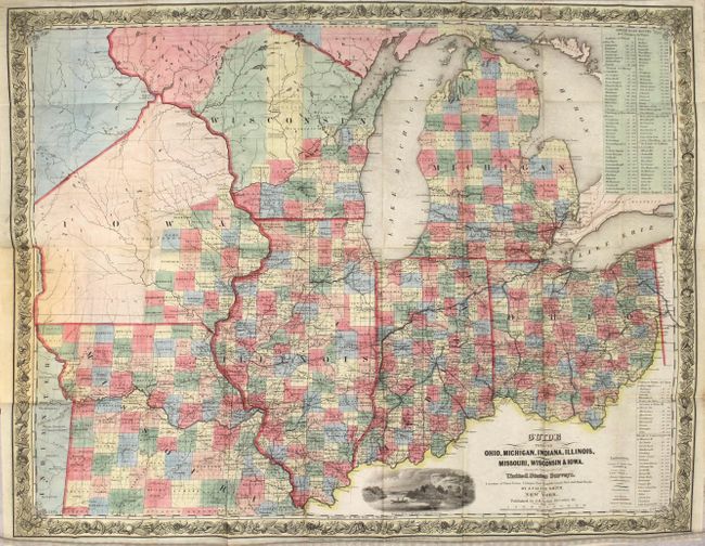
Subject: Central United States
Period: 1845 (published)
Publication:
Color: Hand Color
Size:
24.7 x 19.6 inches
62.7 x 49.8 cm
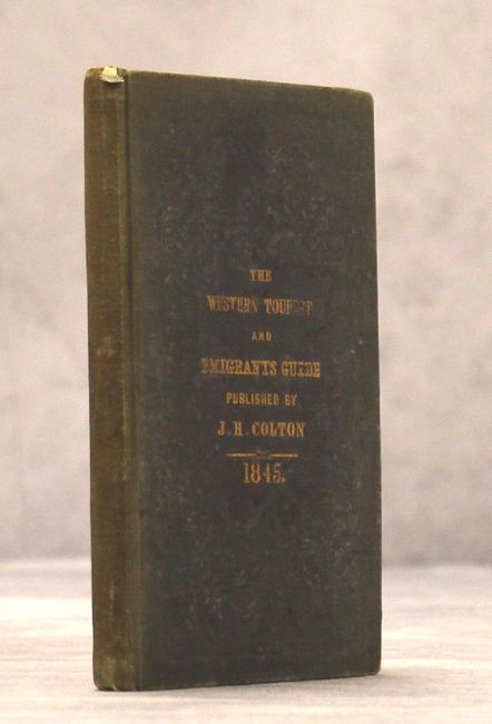
This beautifully engraved pocket map was issued as a guide for travelers and immigrants. It is densely filled with information on stage roads, railroads, political divisions, towns and villages, watershed and canals. The areas of northern Iowa and northern Wisconsin are mostly unsettled. The Indian names are per Schoolcraft in this early edition. A Proposed Military Road to Council Bluffs and Ft. Calhoun is noted. Two large tables list the routing and distances for Steam Boat Routes throughout the area. The map is embellished with a decorative floral border and the engraved vignette "Maidens Rock, Lake Pepin on the Mississippi." Published in Colton's 119-page "Western Tourist and Emigrant's Guide" that has much information on the states and territories the map covers and was marketed to emigrants looking for new farmland.
References:
Condition: B+
A clean, crisp example with a fold separation at top right that extends 1.5" into the image. Covers are sunned.