Subject: World
Period: 1710 (circa)
Publication:
Color: Hand Color
Size:
11.6 x 6.8 inches
29.5 x 17.3 cm
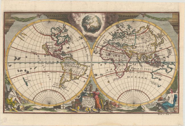
Presented in classical format, this double hemisphere world map depicts North America with the island of California and no Great Lakes. Compagnies Land fills a small part of the vast void that separates Asia from North America. Partial coastlines for Australia and New Zealand reflect the discoveries of Abel Tasman and other Dutch explorers. Allegorical female representations of the four continents fill the bottom of the decorative surround, while garland-draped columns fill the top. Tucked between the spheres in a mass of clouds is a fascinating and imaginative view of the earth as seen from space.
References:
Condition: A
Sharp impression and lovely color. The binding trim at upper right has been expertly replaced to accommodate framing.