Catalog Archive
Auction 161, Lot 119

"Carte qui Contient une Description des Iles & Terres que les Anglois Possedent dans l'Amerique Septentrionale, et en Particulier de la Jamaique...", Chatelain, Henry Abraham

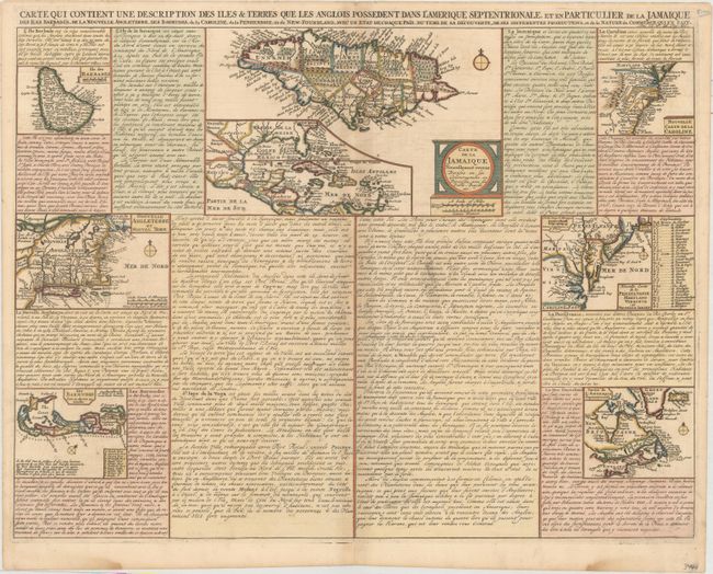
Subject: Colonial Eastern North America, West Indies & Bermuda

Period: 1719 (circa)

Publication: Atlas Historique…

Color: Hand Color

Size:
20.4 x 15.4 inches
51.8 x 39.1 cm
Download High Resolution Image
(or just click on image to launch the Zoom viewer)

A very interesting folio sheet containing seven maps inset into panels of French text. The largest map, Carte de la Jamaique Nouvelle... (9 x 5.7"), shows the island in great detail and includes a large inset of the Gulf of Mexico and West Indies. The other maps illustrate Barbados, Bermuda, and the British colonies in North America (in four regional maps, including Chatelain's only map to exclusively focus on New England). Together these maps cover all of the regions colonized by the English at the early part of the 18th century.

References: McCorkle #719.3.

Condition: B+

A crisp impression on paper with a Strasboug bend & lily watermark. There is a bit of printer's ink residue near the center, very light toning along the centerfold, and damp stains along the bottom edge of the sheet, well away from the image.

Estimate: $240 - $300

Unsold

Closed on 2/8/2017

Archived