Subject: North America
Period: 1862 (dated)
Publication: Atlas Universel
Color: Hand Color
Size:
18.2 x 24.1 inches
46.2 x 61.2 cm
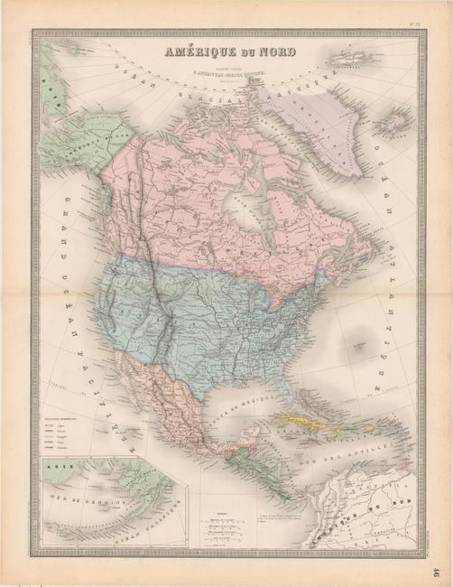
This large, handsome map of North America provides considerably more detail than most continental maps, including state and territory boundaries, towns, roads, forts, Indian tribes, railroads, and sea lanes. The western United States is comprised of the state of California and the large territories of Washington, Oregon, Utah and New Mexico, while the plains region is occupied by Nebraska, Kansas, and Indian territories. A large inset map details Alaska and the Aleutian Islands. A key at lower left identifies the European possessions in the Caribbean.
References:
Condition: A
Nice impression and color with light toning confined to the sheet edges.