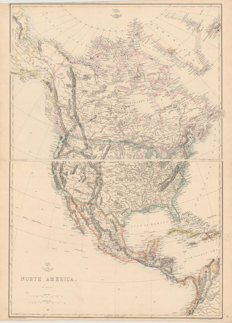
Subject: North America
Period: 1861 (circa)
Publication: Weekly Dispatch Atlas
Color: Hand Color
Size:
17.1 x 12.9 inches
43.4 x 32.8 cm
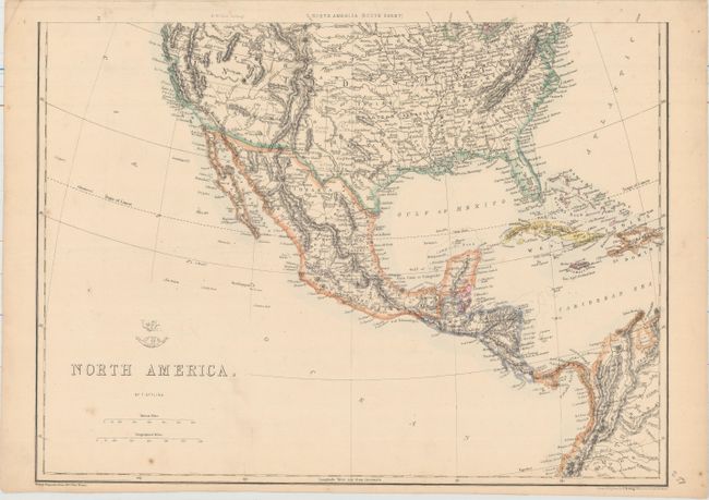
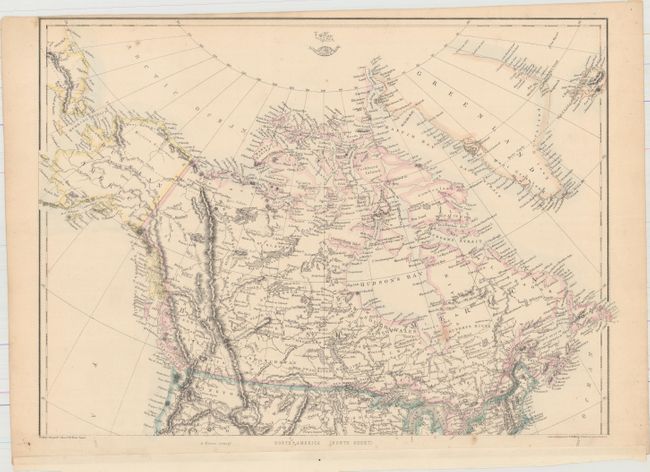
A. [On 2 Sheets] North America. This great map shows early territorial borders in the west. Arizona is shown along the boundary with Mexico in the configuration known as the Confederate Territory of Arizona. Large Nebraska, Kansas, Washington and Oregon territories encompass most of the west. Idaho and Nevada are not yet named. The map is finely engraved showing major towns and settlements, state boundaries, watersheds, forts and Indian tribes. Condition: Minor foxing. (B+)
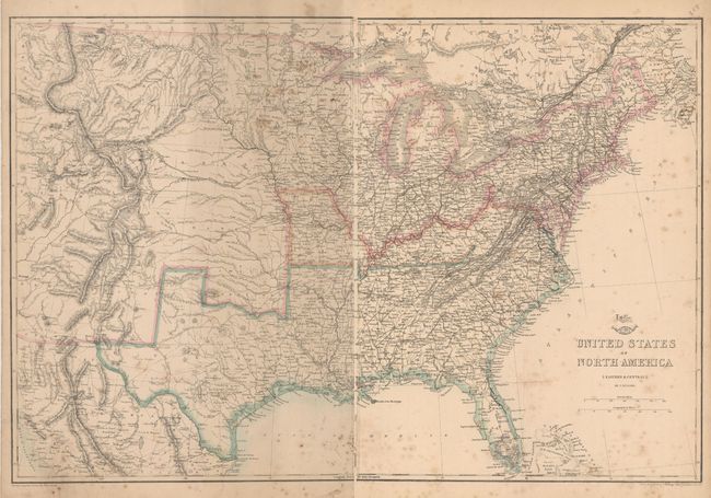
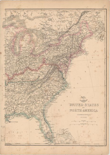
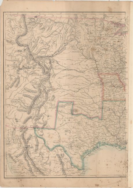
B. [On 2 Sheets] United States of North America (Eastern & Central). This great Civil War map covers the country from the Rocky Mountains to the Atlantic seaboard. Of importance is the designation of the separate Confederate and Union states via hand coloring. The states of Missouri and Kentucky are colored differently to indicate their status as border states containing both pro-Confederate and pro-Union government factions. The Confederate Territory of Arizona is shown along the southern border of New Mexico Territory. The map is finely engraved and detailed, and it shows existing railroads and several possible routes explored for the proposed Pacific Railroads. The tracks of Fremont, Gunnison and others are shown, as are numerous roads, marshes, forts and Indian tribes. Condition: Scattered foxing and minor soiling. (B)
References:
Condition:
See description above.