Subject: North America
Period: 1849 (dated)
Publication:
Color: Hand Color
Size:
24.5 x 18 inches
62.2 x 45.7 cm
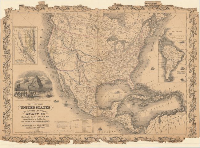
An important map that was one of the most up-to-date of the time. It shows several emigrant routes across the continent, all originating in Independence. This is the first Colton map to identify the gold regions in California, which are hand colored in yellow. The large inset "Map of the Gold Region, California" is also hand colored in yellow to suggest the gold bearing regions. The map further delineates explorers' routes, forts, Native American regions, and much more. An engraved vignette shows Pyramid Lake, Upper California as described by John C. Fremont in 1844. A second inset shows all of South America. There are several variant issues of this map, each adding additional information about the gold regions. This example is reported to have the most information, particularly its inset gold region map, and area along the Feather River labeled "El Dorado or Gold Region." Embellished with six sailing and steam ships. Shows shipping routes and includes a Table of Distances at lower center.
References: Wheat (Gold) #70; Streeter #2534; Wheat (TMW) #591
Condition: C
The map has been reinforced with tissue on verso to stabilize the damage and loss to border at top and bottom. There is no loss of map image, and framing could easily cover the damaged border.