Subject: North America
Period: 1791 (dated)
Publication: Atlante Novissimo
Color: Hand Color
Size:
16.8 x 12.6 inches
42.7 x 32 cm
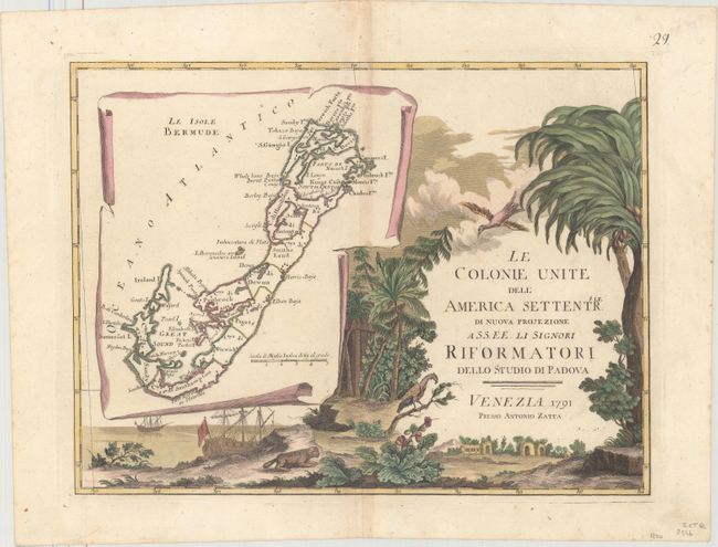
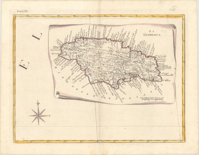
This impressive twelve-sheet map is Antonio Zatta's version of John Mitchell's landmark map with some additional notes relating to both the Treaty of 1763 and events in the Revolutionary War. Most importantly, it was the first printed map devoted to the thirteen states, and to use the a name distinguishing them from their previous status as British Colonies. The name 'United Colonies' was used in the Declaration of Independence and was not officially replaced until the Articles of Confederation adopted the name ‘The United States of America.’ The map covers North America west to the Mississippi and Spanish-owned Louisiana, and north to the Great Lakes. The title appears within a large full-color cartouche, which includes a large inset map of Bermuda and fills one sheet. A second inset shows Florida and the Bahamas, and a third features Jamaica. This set of 12 maps first appeared in Zatta's Atlante Novissimo, which was first published in 4 volumes between 1775-85, with the fourth volume comprising maps of parts of the world outside of Europe. Sizes vary slightly.
A. [Title Sheet] Le Colonie Unite dell' America Settentrle. di Nuova Projezione... [on sheet with] Le Isole Bermude.
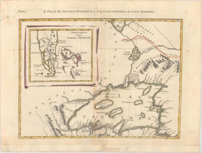
B. Il Paese de Selvaggi Outauchesi, e Kilistinesi Intorno al Lago Superiore. Condition: Light damp stain along the centerfold at bottom and some green ink splatters in top left corner. Bottom margin has been archivally extended.
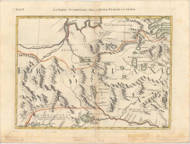
C. La Parte Occidentale della Nuova Francia o Canada. Condition: There are old tape stains in bottom blank margin, although tape has been completely removed. Bottom margin has been archivally extended.
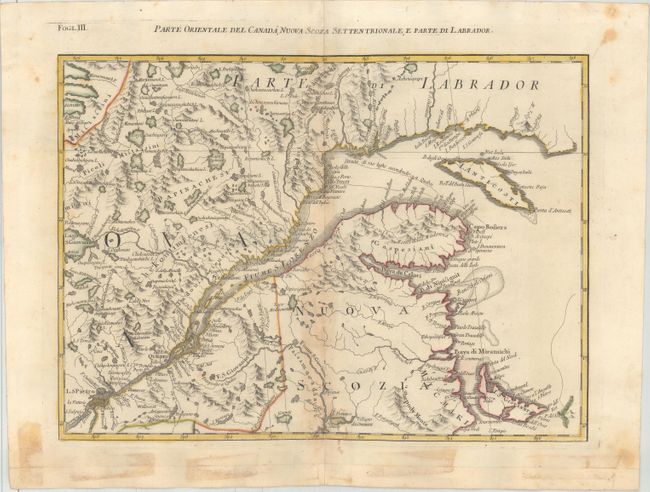
D. Parte Orientale del Canada, Nuova Scozia Settentrionale, e Parte di Labrador. Condition: There are old tape stains in bottom blank margin, although tape has been completely removed. Bottom margin has been archivally extended.
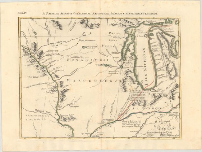
E. Il Paese de' Selvaggi Outagamiani, Mascoutensi, Illinesi, e Parte delle VI. Nazioni.
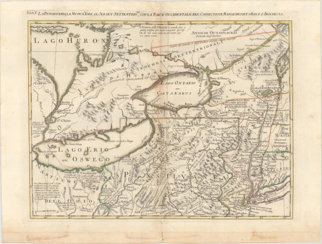
F. La Pensilvania, la Nuova York, il Jersey Settentriole., con la Parte Occidentale del Connecticut, Massachusset-s Baye l'Irochesia. Condition: There are old tape stains in bottom blank margin, although tape has been completely removed. Bottom margin has been archivally extended.
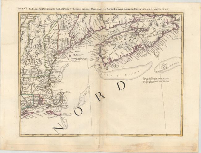
G. L'Acadia, le Provincie di Sagadahook e Main, la Nuova Hampshire, la Rhode Island, e Parte di Massachusset e Connecticut. Condition: There are old tape stains in bottom blank margin, although tape has been completely removed. Bottom margin has been archivally extended.
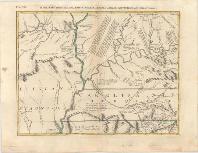
H. Il Paese de Cherachesi, con la Parte Occidentale, deall Carolina Settentrionale, e della Virginia. Condition: There are two abrasions along the centerfold, as well as old tape stains in bottom blank margin, although tape has been completely removed. Bottom margin has been archivally extended.
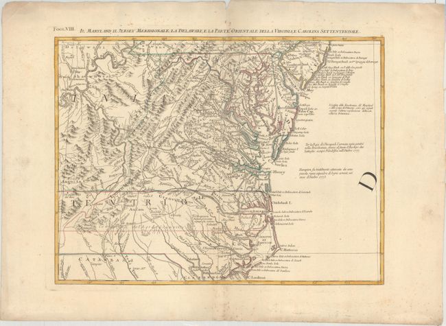
I. Il Maryland, il Jersey Meridionale, la Delaware, e la Parte Orientale della Virginia, e Carolina Settentrionale. Condition: There are small spots of foxing primarily confined to the blank margins.
J. La Giammaica.
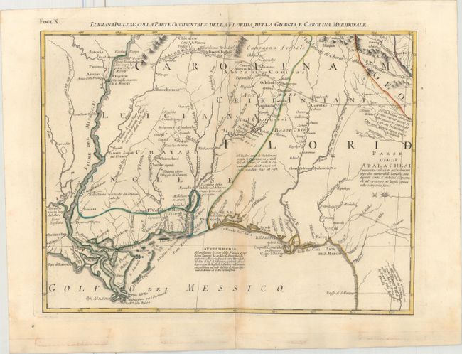
K. Luigiana Inglese, Colla Parte Occidentale della Florida, della Georgia, e Carolina Meridonale. Condition: There are old tape stains in bottom blank margin, although tape has been completely removed. Bottom margin has been archivally extended.
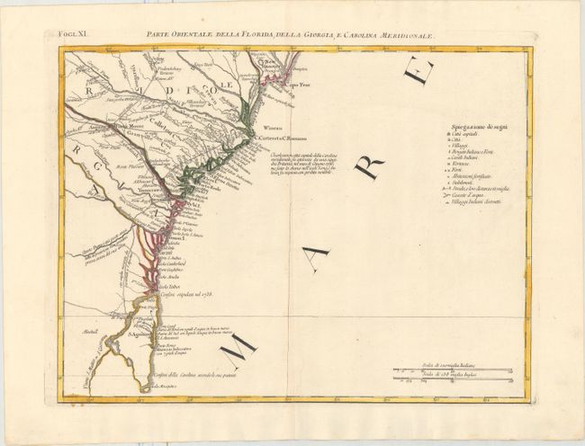
L. Parte Orientale della Florida, della Giorgia, e Carolina Meridionale.
References: Portinaro & Knirsch pp.262-278; MapForum.com Vol. 1; Shirley (BL Atlases) T.ZAT-1a #27-38.
Condition: B+
The maps are in original color on watermarked paper with light centerfold toning and minor soiling. See above for additional details on individual maps.