Subject: Colonial North America
Period: 1763 (published)
Publication: Universal Magazine
Color: Hand Color
Size:
13.4 x 10.3 inches
34 x 26.2 cm
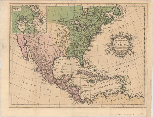
This handsome map of colonial North America was published in the March 1763 issue of Universal Magazine. The colonies and key towns and cities are identified along the East Coast, extending to the northwest; Maryland, for instance, stretches all the way to Lake Erie. The Suppos'd Head of Missasipi appears west of the Great Lakes. In between the vast Louisiana and New Mexico territories is an area labeled Great Space of Land Unknown. Santa Fe is located in the West, and Baja California is depicted. The northwestern portion of the continent is obscured by an inset of Hudson's Bay. Engraved by Richard William Seale.
References: Jolly #UNIV-110; Sellers & Van Ee #108.
Condition: B+
Issued folding on watermarked paper with light scattered foxing. A binding trim at lower right has been repaired on verso with archival tape. Remnants of paper tape on verso.