Subject: References
Period: 1977 (published)
Publication:
Color: Black & White
Size:
10.6 x 14.1 inches
26.9 x 35.8 cm
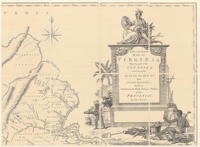
This is a handsome facsimile edition of John Henry's often forgotten map, A New and Accurate Map of Virginia Wherein Most of the Counties Are Laid Down from Actual Surveys..., originally published in 1770. Henry was the father of Patrick Henry and "a dreamer of dreams and a patriot," according to Louis B. Wright in his informative introduction to this edition. Although his map was attacked for its inaccuracies when it was published, it now serves as an invaluable resource for those studying the history of colonial Virginia thanks to its inclusion of both new and old county lines and its relatively comprehensive identification of the colony's plantations. It was engraved and published by Thomas Jefferys. The facsimile was copied from the example in the Library of Congress and printed on four sheets that would measure approximately 53 x 39" if joined. The four sheets and Wright's introduction are inserted into a firm brown portfolio, which slips into a brown slipcase with gilt titling across the front. One of 500 copies.
References:
Condition: A
The map and introduction are in fine condition. Slipcase has minor sunning and shelf wear.