Subject: Northeastern Africa & Arabia
Period: 1720 (circa)
Publication: Atlas Historique…
Color: Hand Color
Size:
20.3 x 15.8 inches
51.6 x 40.1 cm
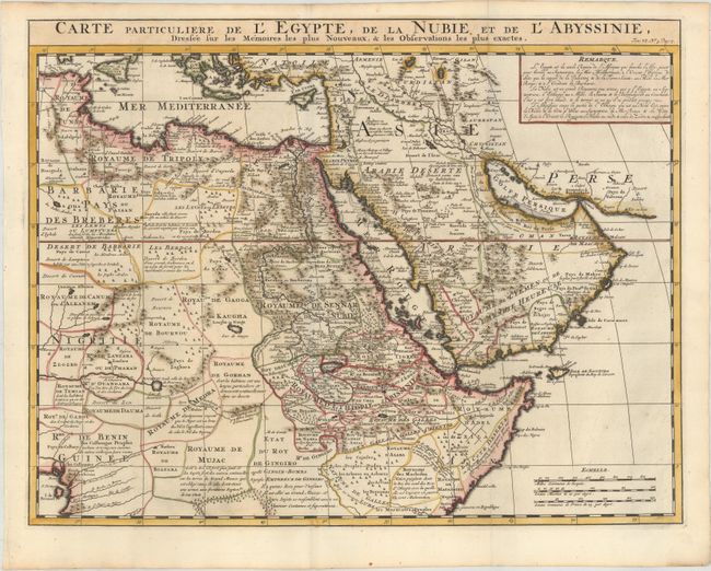
This handsome map is based on the work of the important French cartographer Guillaume Delisle. It is a very detailed and fascinating view of northeastern Africa, the Red Sea and the Arabian Peninsula showing the political divisions and kingdoms. The Blue Nile originates in the mountains near the L. de Dambee in the approximate location of Lake Tana, but there is no sign of Lake Victoria at the head of the White Nile. The desert west of Egypt is filled with comments and little tents and castles distinguish the nomadic tribes versus the permanent settlements. There was increased interest in this region in the early 18th century that coincided with increased commercial activity. By this time European knowledge of the coastlines of the African continent and Arabia had advanced considerably, but the interiors still remained largely speculative.
References:
Condition: A+
A crisp impression, issued folding on paper with a Strasbourg bend and lily watermark and very minor soiling along the edges of the sheet.