Subject: Africa
Period: 1658 (published)
Publication: Praecipuarum Universi Terrarum Orbis
Color: Hand Color
Size:
4.2 x 2.5 inches
10.7 x 6.4 cm
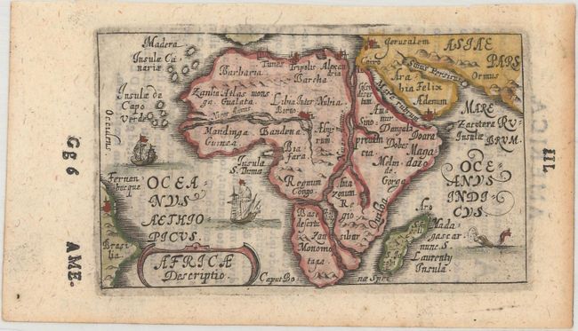
Bucelin's charming map of the continent of Africa was based on the Ortelius-Galle model. Its most notable feature is the oversized Nile River that appear to bisect the continent, flowing north, south and west out of Zaire Lake. The place names are also derived from the Ortelius pocket map of Africa. Two tiny sailing ships and a sea monster decorate the seas. Bucelin's maps in his Praecipuarum Universi were copperplate engravings based on the Ortelius miniature maps. His atlas contained 30 maps and was published by Johann Praetorius and Johann Gorlinus in 1658 and 1664. Bucelin's maps are very scarce. Latin text on verso.
References: Betz #90; King (2nd ed.) pp. 126-127.
Condition: A
A nice impression with light show-through of text on verso and minor toning along the edges of the sheet.