Subject: Japan & Korea
Period: 1658 (published)
Publication: Praecipuarum Universi Terrarum Orbis
Color: Hand Color
Size:
4.2 x 2.5 inches
10.7 x 6.4 cm
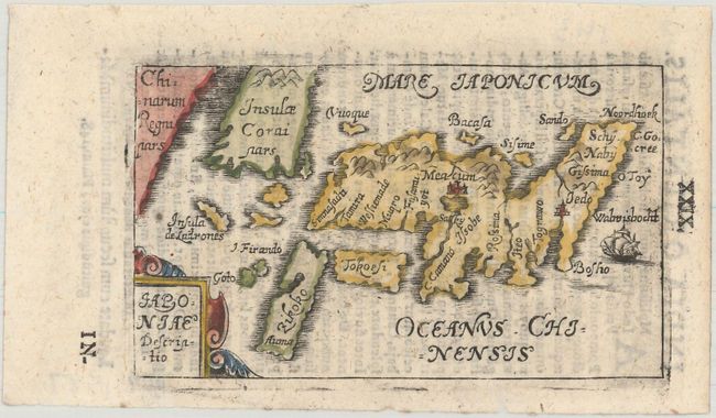
This tiny map is based on the Dudley/Jansson maps of Japan. It is interesting that Bucelin chose this source when the standard Catholic version of Japan was based the Blancus/Moreira cartography. Most of the other maps in the Historiae Universalis were based on Ortelius - making this all the more curious. Kyushu is labeled Zikoko, which was derived from Dutch sources. Korea is labeled as an island. Bucelin's atlas contained 30 maps and was published by Johann Praetorius and Johann Gorlinus in 1658 and 1664. Bucelin's maps are very scarce. Latin text on verso.
References: Hubbard #29; King (2nd ed.) pp. 126-127; Walter #56 & OAG-29.
Condition: A
A nice impression with light show-through of text on verso.