Subject: Arabia, Egypt
Period: 1787-89 (dated)
Publication:
Color:
Size:
14.6 x 22.4 inches
37.1 x 56.9 cm
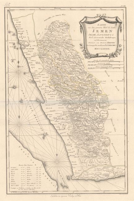
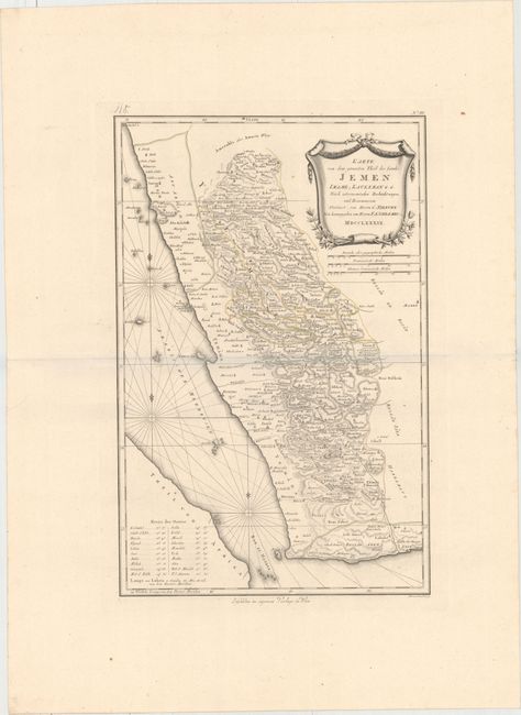
A. Karte von dem Groessten Theil des Landes Jemen Imame, Kaukeban &. &..., dated 1789, hand color (14.6 x 22.4"). This detailed and finely engraved map of Yemen is based on the observations of the Danish explorer Carsten Niebuhr and shows the eastern shore of the Red Sea just to the north of Jizan. Numerous towns, cities, and Wadis are shown interlaced in the dense hachuring to suggest topography. The Red Sea is filled with three compass roses, fleur-de-lis and rhumb lines. In the lower left an index gives latitude and longitude for the major cities. At upper right is an elaborate title cartouche with three distance scales below.
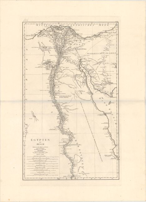
B. Egypten oder Misir, dated 1787, black & white (16.1 x 26.1"). This map of eastern Egypt depicts the Nile River Valley and the Red Sea, from Aswan to the Mediterranean. It is based upon d'Anville's Egypte nommee dans le pays Missir. Filled with details including the location of emerald mines, ancient ruins, and caravan routes. Includes nine distance scales below the title.
References: Phillips (A) #694.
Condition: A
Strong impressions on heavy sheets of watermarked paper with wide margins and a few faint spots.