Catalog Archive
Auction 160, Lot 623

"A Correct Chart of the Mediterranean Sea, from the Straits of Gibraltar to the Levant; from the Latest and Best Observations", Seale, Richard William

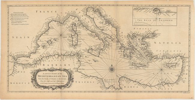
Subject: Mediterranean

Period: 1751 (circa)

Publication: Tindal's Continuation of Rapin's History…

Color: Black & White

Size:
27.7 x 13.5 inches
70.4 x 34.3 cm
Download High Resolution Image
(or just click on image to launch the Zoom viewer)

Finely engraved and detailed chart of the Mediterranean focusing only on the coastlines. A large inset features The Road of Leghorn (Livorno harbor). Includes a decorative compass rose with radiating rhumb lines & notes on known & unknown latitudes & longitudes, plus a very decorative title cartouche.

References: Shirley (BL Atlases) G.RAP-2a #19.

Condition: B+

Issued folding with light toning, a few small stains, and a fold separation at bottom that extends 0.5" into the image. A few other minor separations and edge tears are all confined to the blank margins.

Estimate: $325 - $400

Sold for: $145

Closed on 11/16/2016

Archived