Catalog Archive
Auction 160, Lot 54

"Hemisphere Meridional pour voir Plus Distinctement les Terres Australes", Delisle, Guillaume
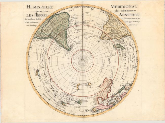
Subject: South Pole

Period: 1714 (dated)

Publication:

Color: Hand Color

Size:
17.8 x 17.9 inches
45.2 x 45.5 cm
Download High Resolution Image
(or just click on image to launch the Zoom viewer)

Delisle's map depicting the Southern Hemisphere shows the tracks of the explorers and circumnavigators around the southern oceans including Magellan in 1520, Abel Tasman in 1642, and Edmund Halley in 1698-1700. The map provides very good detail, particularly of the explorations and discoveries in the South Pacific. Australia, New Guinea, Tasmania, and New Zealand are partially delineated, with Australia and New Guinea nearly attached to one another.

References: Tooley (Australia) p. xxxi, #42.

Condition: A

A nice impression on a watermarked sheet with minor offsetting and soiling, and light damp stains that are confined to the blank margins.

Estimate: $475 - $600

Sold for: $300

Closed on 11/16/2016

Archived