Catalog Archive
Auction 160, Lot 53

"A Correct Draught of the North Pole and of All the Countries Hitherto Discovered, Intercepted Between the Pole and the Parallel of 50 Degrees...", Bowen, Emanuel
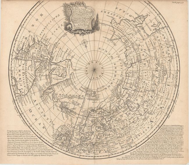
Subject: North Pole

Period: 1748 (circa)

Publication: John Harris' Navigantium Atque Itinerantium Bibliotheca...

Color: Black & White

Size:
16.6 x 15.4 inches
42.2 x 39.1 cm
Download High Resolution Image
(or just click on image to launch the Zoom viewer)

A highly detailed map that shows the tracks of navigators in their numerous attempts to find a northern passage to the economic riches of Asia. The map shows great information on the hunt for the Northwest Passage via Hudson Bay. Much of Greenland and the western part of North America remain undiscovered. A decorative title cartouche obscures the unknown northwest coast. Panels of English text at the bottom describe the explorations and probabilities of finding a Northwest Passage via Hudson Bay, with particular interest in the outcome of the 1746 Arthur Dobbs expedition.

References: Shirley (BL Atlases) G.HARR-1a #21; Kershaw #418.

Condition: B+

On watermarked paper with light offsetting.

Estimate: $375 - $450

Sold for: $200

Closed on 11/16/2016

Archived