Catalog Archive
Auction 160, Lot 485

"Regionis, quae est Circa Londinum, Specialis Repraesentatio... / Ausfuhrliche Geographische Vorstellung der Gegend m London...", Homann Heirs

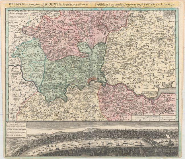
Subject: London, England

Period: 1741 (dated)

Publication:

Color: Hand Color

Size:
22.3 x 19.3 inches
56.6 x 49 cm
Download High Resolution Image
(or just click on image to launch the Zoom viewer)

This very detailed map centered on London was originally produced by Thomas Bowles. It covers the vicinity from Maidenhead to Rochester. The map extends to include P. High Wickham, Chelmsford, Bishops Stratfort, and below Rochester. The lower quarter is a bird's-eye view of London and Westminster from Southwark from across the Thames, which is densely filled with boats and ships of all description. The legend uses icons to locate towns, market towns, parish churches, gentlemen's houses, castles, wind and water mills, and villages.

References: Howgego #88.

Condition: A

Full original color on watermarked paper with minor soiling and a narrow bottom margin, as issued. Remnants of hinge tape on verso.

Estimate: $650 - $800

Sold for: $450

Closed on 11/16/2016

Archived