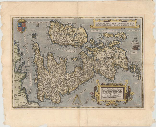
Subject: Britain
Period: 1598 (published)
Publication: Theatrum Orbis Terrarum
Color: Hand Color
Size:
19.7 x 13.6 inches
50 x 34.5 cm
This map, based on the cartography of Gerard Mercator, is Ortelius' earliest map of Britain. Flemish influence, or possibly a mistranslation, is evident in the rendering of some of the place names, e.g. Ormyskyrk for Ormskirk, Dantre for Daventry, and the omission of the relatively important Peterborough. Distinguished by a sophisticated style of engraving, the map is embellished with two ornate strapwork cartouches, the royal coat of arms of the UK, dividers and distance scale and five sailing ships. French text on verso with page 10 at bottom.
References: Shirley (MCC-94) #86, pl. 42; Van den Broecke #16.
Condition: B+
A dark impression on watermarked paper with a horizontal misfold across the center of the image with a few tiny separations. There is a printer's crease adjacent to the centerfold, faint mat burn outside the map border, and several edge chips confined to the blank margins. Remnants of paper tape on verso.