Subject: Northwestern South America & Panama
Period: 1671-1779 (circa)
Publication:
Color: Black & White
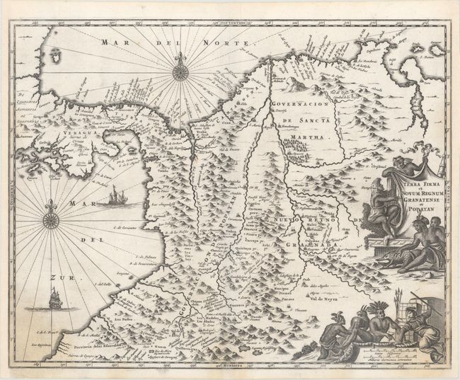
A. Terra Firma et Novum Regnum Granatense et Popayan, by Arnoldus Montanus, from De Nieuwe en Onbekende Weereld, circa 1671 (14.4 x 11.4"). Attractive map of the Isthmus of Panama and northwestern South America including most of present day Columbia and part of Venezuela. The map is based on the cartography of Hondius, which was in turn based on the work of Hessel Gerritsz. The decorative embellishments include numerous native figures, an armadillo, a llama, sailing ships and compass roses. Condition: A dark impression on paper with a jester watermark and light damp stains in bottom corners. Professionally remargined at right and left.
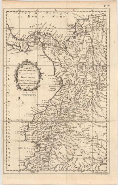
B. Carte des Pays Situe sur la Mer du Sud Depuis Panama Jusqu'a Guayaquil pour l'Histoire de l'Amerique par le Dr. Robertson, by William Robertson, from Histoire de l'Amerique, circa 1779 (9.4 x 14.5"). This map stretches from Costa Rica to Colombia, to the tip of Peru in the south, and depicts the towns, rivers and a few roads. The map is adorned by a decorative floral title cartouche and a simple compass rose. Engraved by Benard. Condition: Folding, as issued, on watermarked paper with a binding trim at left, a few short fold separations, and minor offsetting.
References:
Condition: B+
See description above for details.