Subject: Jamaica
Period: 1714-1896 (circa)
Publication:
Color:
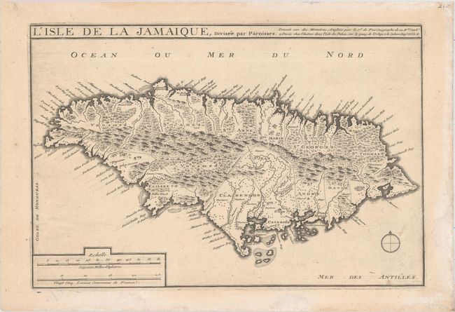
A. L'Isle de la Jamaique, Divisee par Paroisses Dressee sur des Memoires Anglois..., by Nicolas de Fer, from Suite de l'Atlas Curieux, circa 1714 (13.7 x 9.1"). Strongly engraved and detailed map that shows the island of Jamaica divided into parishes. The map shows remarkable detail with scores of place names along the coast plus mountains, rivers, watershed, and other details in the interior. Ref: Kapp (MCC-42) #52; Pastoureau, FER 1C [222]. Condition: A crisp impression on watermarked paper. There are light damp stains along the sheet's edges, well away from map image.
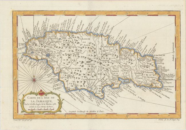
B. Carte de l'Isle de la Jamaique, by Jacques Nicolas Bellin, from Prevost's Histoire Generale des Voyages, dated 1758 (12.6 x 8.2"). Strongly engraved map describes this island of the Greater Antilles. Divided by parishes, the map shows remarkable detail with scores of place names along the coast plus mountains, personal estates, watershed, and other details in the interior. At lower left is a decorative rococo-style title cartouche with compass rose and rhumb lines above. Ref: Kapp (MCC-42) #77; Sellers and Van Ee #1917. Condition: A nice impression.
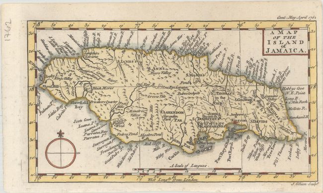
C. A Map of the Island of Jamaica, by John Gibson, from Gentleman's Magazine, dated 1762 (7.3 x 4.1"). Fascinating little map of Jamaica that includes Mantica Bay (Montego Bay) as well as Ocho Rios. There are only nine of Jamaica's 14 current parishes noted on this map, with Hanover, Manchester, Portland, Trelawney, and Westmoreland not yet developed. However, there are two parishes on this map that seem to have vanished: St. David's and St. George's. The historic, rugged region of the Cockpit Country is noted on this map as is Pedro's Cockpits. The Spanish fled the island in 1655 when the British took over, at which time the Spanish freed their slaves. This group of freed slaves were called Maroons, and in 1738 they were able to strategically use the inaccessibility of the Cockpit Country and force a treaty with the British during the First Maroon War. Ref: Jolly GENT-158; Kapp (MCC-42) #83. Condition: A nice impression.
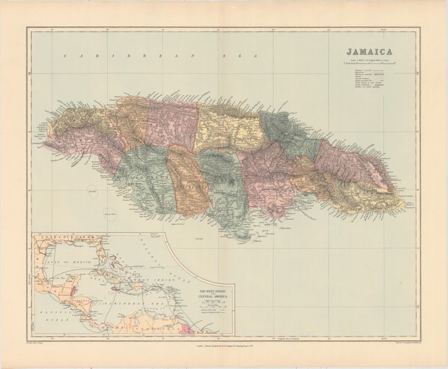
D. Jamaica, by Edward Stanford, from London Atlas, circa 1896 (23.6 x 18.6"). This striking atlas map of Jamaica divides the island into its 14 parishes. It locates the chief towns of each parish, railways, schools, churches, roads, districts, and more. There is nice topographical detail with elevations noted. An inset appears at bottom left: The West Indies and Central America. Condition: Near fine.
References:
Condition: A
See description above.