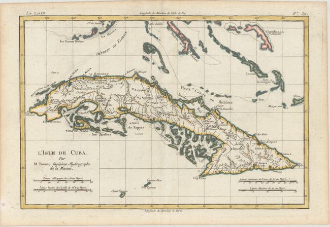
Subject: Cuba
Period: 1780 (circa)
Publication: Atlas de Toutes les Parties Connues du Globe Terrestre
Color: Hand Color
Size:
12.6 x 8.4 inches
32 x 21.3 cm
Attractive copperplate engraving of Cuba and the Bahamas. It is geographically accurate with some overall scale distortion, most notably in present-day Bay de Buena Vista, Golfo de Batabano, and Golfo de Guacanayabo. In the lower part of the map are the Cayman Islands and in the north are part of the Florida Keys to include the Tortugas. Interior and coastal information includes shoals, towns, missions, hospitals and plantations. The southern coast is a fragmented collection of islands and shoals.
References:
Condition: A
A crisp impression on watermarked paper with a hint of offsetting and one small abrasion in the word "Bahama" of "Vieux Canal de Bahama."