Subject: World
Period: 1819 (dated)
Publication:
Color: Hand Color
Size:
26.1 x 19.6 inches
66.3 x 49.8 cm
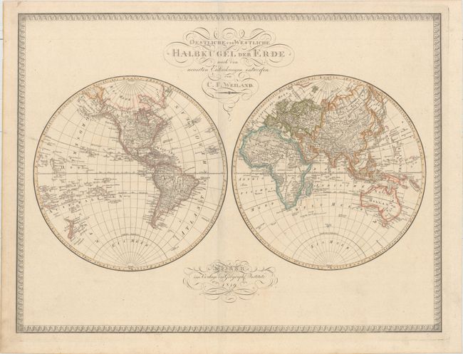
This double-hemisphere world map includes a good amount of detail within the continents. Rivers and cities are named throughout, and mountains are depicted by parallel lines of hachures, giving them an interesting caterpillar-like look. There are several spurious mountains running east-west in North America, although Alaska is fairly well formed and Baffin's Bay is fully delineated to the north. Central Africa and Australia still remain relatively devoid of information. Antarctica has yet to be discovered, and the most southerly islands depicts are Sandwich Land and Kerguelens Land, both at 60 degrees south latitude. Surrounded by an elegant engraved border. Published by the Weimar Geographisches Institute.
References:
Condition: A
Original outline color with minor toning and a few insignificant spots.