Catalog Archive
Auction 160, Lot 366

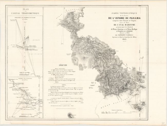
"Carte Topographique de la Partie de l'Isthme de Panama Comprise Entre Panama et Chagres avec le Trace du Canal Maritime...",

Subject: Central America, Panama Canal

Period: 1845 (dated)

Publication:

Color: Black & White

Size:
18.7 x 15.2 inches
47.5 x 38.6 cm
Download High Resolution Image
(or just click on image to launch the Zoom viewer)

This early map details Napoleon Garella's proposed canal route to the French government, who had secured a concession for the construction of a highway, railroad, or a canal across the isthmus. Garella's recommended route is shown from Limon Bay to the bay of Boca del Monte. As with numerous other proposals, this one failed due to lack of capital resources. The map itself includes very good detail of topography, the river systems, and features two inset maps showing detailed triangulations of the region.

References: Phillips (Maps) p. 655.

Condition: A

A clean and bright example, issued folding and now flattened and backed with tissue.

Estimate: $140 - $170

Sold for: $100

Closed on 11/16/2016

Archived