Subject: United States & Mexico
Period: 1836 (circa)
Publication: A Comprehensive Atlas Geographical, Historical & Commercial
Color: Hand Color
Size:
9.9 x 7.8 inches
25.1 x 19.8 cm
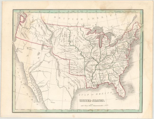
A. United States. This great pre-Mexican War map shows Mexico in control of the Southwest and California. Texas is still shown as part of Mexico. Above Texas is an unnamed Missouri Territory including the Great American Desert stretching to Canada. Iowa Territory is in it's largest configuration, and Oregon District takes in the entire Northwest and extends well into Canada, reflecting U.S. interests in the region. The map is filled with place names, the location of Indian tribes, and details the river systems. Condition: Faint damp stains at left and right and a few spots of foxing. (B)
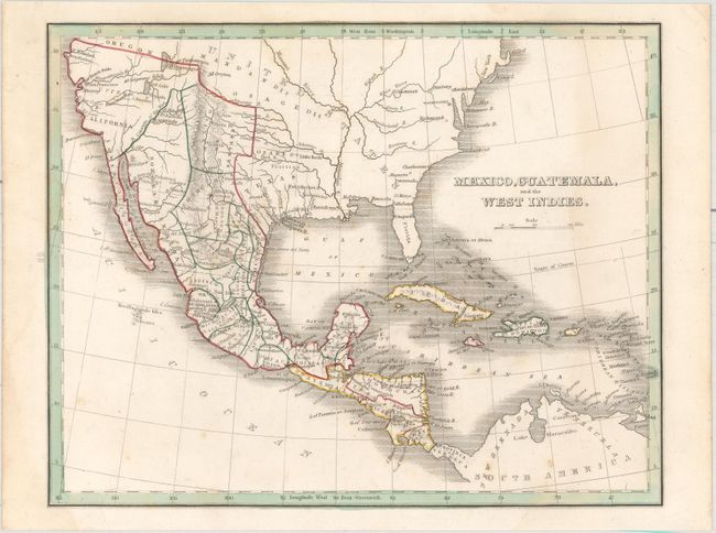
B. Mexico, Guatemala, and the West Indies. This map was published shortly after the Texas Revolution and shows an independent Republic of Texas. Mexico is in control of the Southwest and California with its northern boundary being Oregon Territory. Settlements within Texas include Austin, St. Antonio, Victoria, and Matagorda. Other place names include San Francisco, San Diego, Santa Fe and S. Juan in place of Taos. The Great Salt Lake is shown with the settlement Brigsda to the south and is connected to the ocean via the fictitious R. Buenaventura. The map extends to show all of Central America and the Caribbean. Condition: Minor soiling. (B+)
References:
Condition:
Original color. See above for additional details.