Subject: Western Virginia, Atlases
Period: 1885 (published)
Publication:
Color: Hand Color
Size:
14.8 x 17.4 inches
37.6 x 44.2 cm
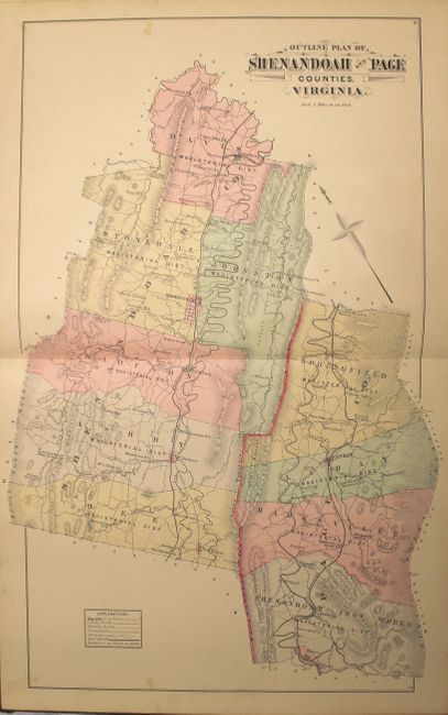
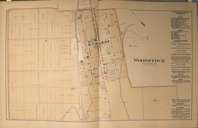
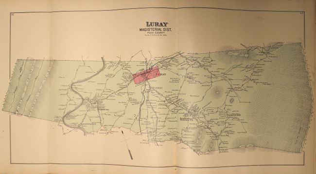
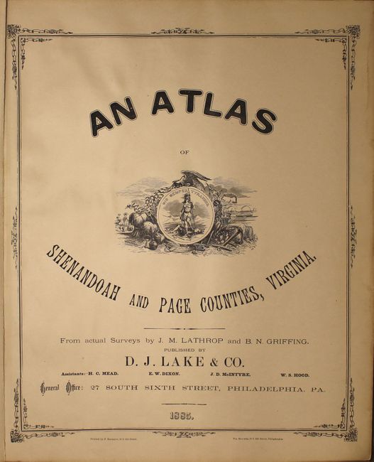
This atlas consists of 17 double-page maps and 4 single page maps depicting Shenandoah and Page Counties, their magisterial districts, and a number of town plans, as well as maps of the world, the United States, and Virginia and West Virginia. Included is a map of the Luray Magisterial District, showing the entrance to Luray Caverns, which were discovered in 1878. The district maps and town plans show individual land owners, and are often accompanied by a business directory for the area. Towards the back of the atlas are two pages listing the patrons of the atlas, including information on the number of acres held by each landowner, their occupation, and the date of their settlement. Population data for each county in each U.S. state are given based on the 1870 and 1880 censuses. The double-hemisphere world map (dated 1879) includes comparative diagrams of the rivers and mountains of the world. Published by D. J. Lake & Co. in Philadelphia. Hardbound in quarter leather with original black cloth embossed boards.
References:
Condition: B+
The maps are generally very good to near fine with mild toning, occasional spots of soiling, and several short centerfold separations or edge tears. The maps of the Johnston Magisterial District and Marksville Magisterial District have moderate soiling. The title page, index, and front free end paper are beginning to separate from text. The covers and spine show moderate wear.