Catalog Archive
Auction 160, Lot 30

"Wereld-Kaart na de Alderlaatste Ontdekking in't Licht Gebragt", Tirion, Isaac
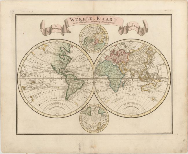
Subject: World

Period: 1744 (dated)

Publication:

Color: Hand Color

Size:
16.7 x 13.1 inches
42.4 x 33.3 cm
Download High Resolution Image
(or just click on image to launch the Zoom viewer)

Handsome double hemisphere map with polar projections tucked between the spheres at the top and bottom. The Western Hemisphere shows the entire Northwest coast of North America blank with only the western shore of New Zealand mapped. In the Eastern Hemisphere, Nieuw Holland is shown for Australia with only the northern and western coastlines, which are connected to New Guinea. Tasmania (Van Diemens Land) is shown just below with several place names. The map is titled with a large, ribbon-style cartouche. Engraved by C. Sepp.

References:

Condition: A

Original color on watermarked paper with marginal soiling.

Estimate: $400 - $500

Sold for: $250

Closed on 11/16/2016

Archived