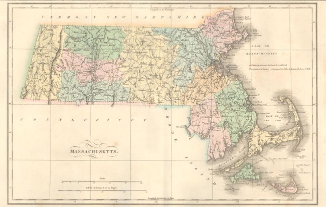
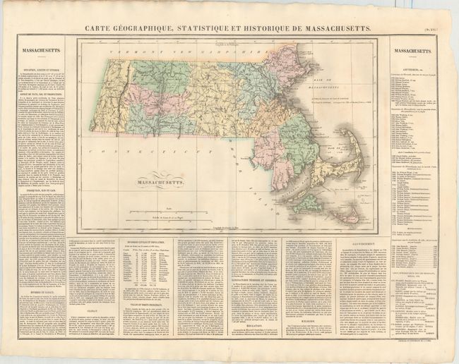
Subject: Massachusetts
Period: 1825 (circa)
Publication: Atlas Geographique, Statistique, Historique ... des Deux Ameriques
Color: Hand Color
Size:
17.8 x 11.6 inches
45.2 x 29.5 cm
This map is from the French edition of Carey & Lea's American Atlas, with French text surrounding the map on three sides of the large folio sheet. It is a beautiful map of the state with counties, roads, and towns all well delineated. County configuration is current to 1821, just after Maine gained its statehood from Massachusetts in 1820. The surrounding text includes information on topography, climate, and major cities, population figures by county, and a list of governors from John Carver to John Brooks. Buchon's maps were printed on better quality paper than its American counterpart. Photocopy of the atlas title page accompanies the map. Overall size, including text, is 24.7 x 18.5".Measures 24.9 x 18.5" with text.
References:
Condition: A
A nice impression with original color with minor scattered foxing. There are a couple of tiny holes adjacent to the centerfold at top and bottom and a couple of short tears at bottom, all confined to the blank margins.