Subject: Maine
Period: 1838 (published)
Publication: Sen. Doc. 502, 25th Cong., 2nd Sess.
Color:
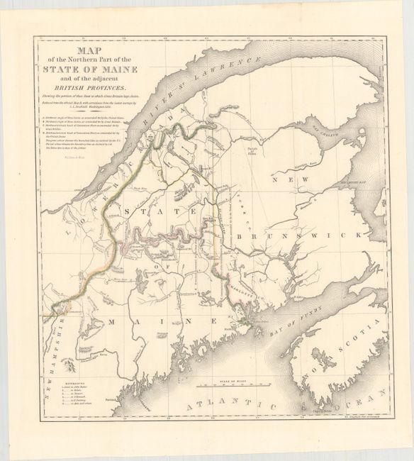
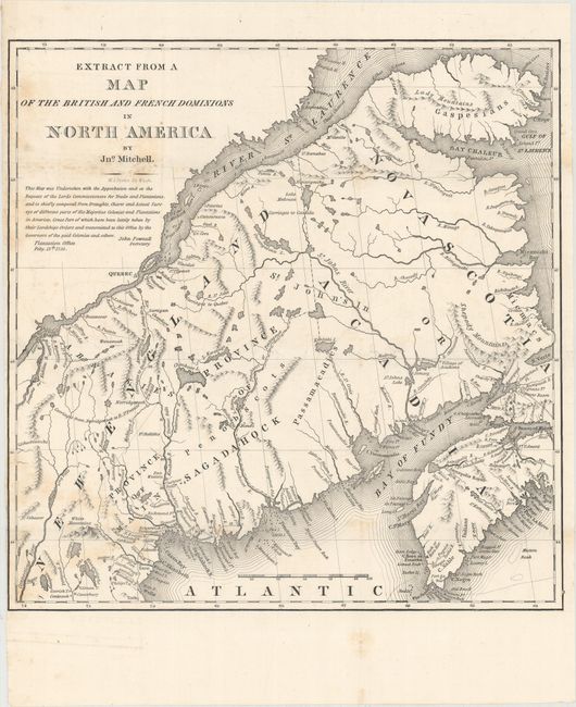
The first map details the boundary dispute between the United States and Great Britain relating to Maine. Hand coloring is used to show the boundary as claimed by the United States and by Great Britain, with a third line labeled "that of the Arbiter" which closely corresponds to Maine's present-day border with Canada. A table gives the major points of contention in this border dispute. Another table names land grants belonging to six land holders. The second slightly smaller map was included in the same Senate report for historical purposes. It was extracted from Mitchell's map of 1755 by W.J. Stone.
A. Map of the Northern Part of the State of Maine and of the Adjacent British Provinces..., hand color (15.4 x 16.5"). Condition: A near fine example with a nearly invisible 3" edge tear at right that has been closed on verso with archival tape. (A)
B. Extract from a Map of the British and French Dominions in North America, black & white (13.2 x 13.4"). Condition: Light scattered foxing along the folds. (B+)
References: Claussen & Friis #223; Phillips (M) p. 384.
Condition:
Issued folding. See description above for details.